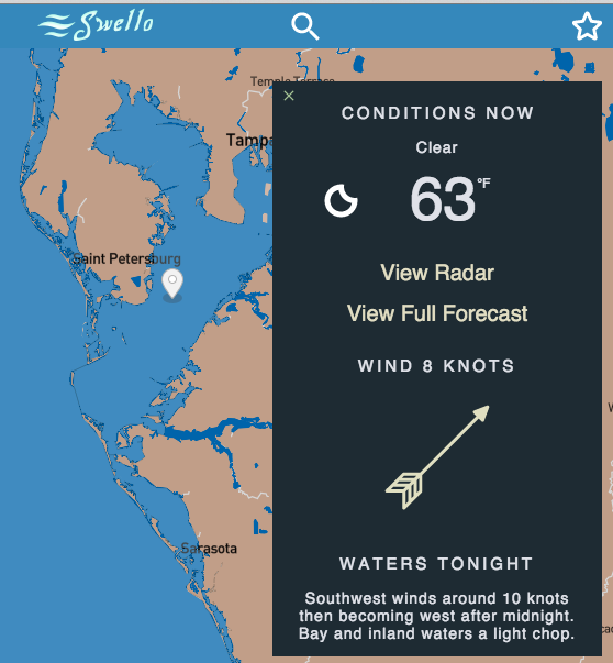
Marine weather forecast mashup powered by NOAA and Forecast.io

- Marine zone forecasts from NOAA found here are crawled using crawl-and-write-zone-links.js to get an index of available forecast zones.
- Each available forecast is parsed through parseForecastText.js. If a zone fails parsing, it is removed from the index of zones. This maintenance task is handled by write-zone-links-good.js
- Geo shape files found here representing each geographic forecast zone are converted to GeoJSON using mapshaper.org. This is required everytime NOAA updates their zones (very rare).
- GeoJSON is filtered down to forecast zones the parser can handle (there are a small amount that the parser can't handle). This is handled by write-zones-geometry-good.js
- Express API
/api/marinetakes zoneId - URL gets looked up from available zone forecast index
- parseForecastText.js parses the forecast
- timestamps are generated for each forecast day
- Express API
/api/forecasttakes geo coordinates - Calls Forecast.io DarkSky API and gets weather forecast
- Redux reducer takes timestamps from both forecasts (noaa and forecast.io) and mashes them together into one weather forecast object.
- ReactJS renders forecast with react-collapse and react-motion to make it pretty.
- Also powering this project
- CSS Modules
- Mapbox GL JS
- Wunderground API for animated weather radar
- Climacons by Adam Whitcroft
- Codeship.com for CI
Tampa Bay ocean depth data is shown in feet on the satellite map layer mapbox://styles/jcmuse/cikcm77hi007l9fm127xym4v1
- Download ENC chart from NOAA using the Interactive Chart catalog
- Use ogr's S-57 driver to convert to shapefile, e.g.
ogr2ogr --config OGR_S57_OPTIONS RETURN_PRIMITIVES=ON,RETURN_LINKAGES=ON,LNAM_REFS=ON,SPLIT_MULTIPOINT=ON,ADD_SOUNDG_DEPTH=ON -nlt POINT25d US4FL10M.shp US4FL10M.000 SOUNDGBlog Post: Processing S57 soundings - Open in a GIS editor tool, e.g. QGIS and convert meters to feet
- Upload shapefile to Mapbox Studio and add to style
- see server.js and client.js config files
- enter tokens/keys from mapbox, forecast.io, and wunderground
cd client && npm install && npm run startcd server && npm install && npm run serve- Webpack dev server runs on
http://localhost:8080by default
- Celsius option
- Build React Native iOS/Android versions
- Implement auth so favorites can persist beyond local storage
- Get rid of inline functions (react/jsx-no-bind)